


Voting District 160713, Androscoggin County, Maine
About
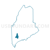
Outline

Summary
| Unique Area Identifier | 591436 |
| Name | Voting District 160713 |
| County | Androscoggin County |
| State | Maine |
| Area (square miles) | 10.99 |
| Land Area (square miles) | 10.70 |
| Water Area (square miles) | 0.29 |
| % of Land Area | 97.35 |
| % of Water Area | 2.65 |
| Latitude of the Internal Point | 44.09479800 |
| Longtitude of the Internal Point | -70.13156610 |
Maps


Graphs
Select a template below for downloading or customizing gragh for Voting District 160713, Androscoggin County, Maine


Neighbors
Neighoring Voting District (by Name) Neighboring Voting District on the Map
- Voting District 160703, Androscoggin County, ME
- Voting District 160723, Androscoggin County, ME
- Voting District 160733, Androscoggin County, ME
- Voting District 160743, Androscoggin County, ME
- Voting District 170751, Androscoggin County, ME
Top 10 Neighboring County Subdivision (by Population) Neighboring County Subdivision on the Map
- Lewiston city, Androscoggin County, ME (36,592)
- Sabattus town, Androscoggin County, ME (4,876)
- Greene town, Androscoggin County, ME (4,350)
Top 10 Neighboring Place (by Population) Neighboring Place on the Map
Top 10 Neighboring Unified School District (by Population) Neighboring Unified School District on the Map
- Lewiston, ME (36,592)
- School Administrative District 52, ME (12,410)
- Regional School Unit 04, ME (10,116)
Top 10 Neighboring State Legislative District Lower Chamber (by Population) Neighboring State Legislative District Lower Chamber on the Map
- State House District 72, ME (9,262)
- State House District 75, ME (9,226)
- State House District 70, ME (8,668)
- State House District 71, ME (8,597)
- State House District 73, ME (8,324)
- State House District 74, ME (8,156)
Top 10 Neighboring State Legislative District Upper Chamber (by Population) Neighboring State Legislative District Upper Chamber on the Map
Top 10 Neighboring 111th Congressional District (by Population) Neighboring 111th Congressional District on the Map
Top 10 Neighboring Census Tract (by Population) Neighboring Census Tract on the Map
- Census Tract 208, Androscoggin County, ME (7,556)
- Census Tract 465, Androscoggin County, ME (6,492)
- Census Tract 207, Androscoggin County, ME (4,891)
- Census Tract 460, Androscoggin County, ME (4,350)
- Census Tract 205, Androscoggin County, ME (3,713)
- Census Tract 206, Androscoggin County, ME (2,708)